
Maps of Yosemite National
Park
Courtesy of the National Park Service
The map links listed on the page are all taken from the same map, but have been sectioned into useful quick loading images, designed to help you with planning for activities while visiting Yosemite National Park. If you would like to download the entire map (2mb PDF file - Official park map), here is the link: http://data2.itc.nps.gov/parks/yose/ppMaps/YOSEpark2003.pdf
Caution: These maps are for planning only and should not be used for hiking. Please use appropriate USGS topo maps. Please contact the United States Geological Survey office or other reputable sources for appropriate maps.
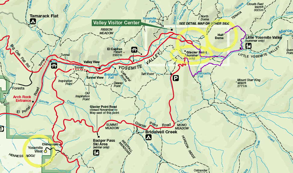 Map showing roads from Yosemite West, to Yosemite Valley, Glacier Point, and trails to Half Dome from both Yosemite Valley, and Glacier Point trail heads. |
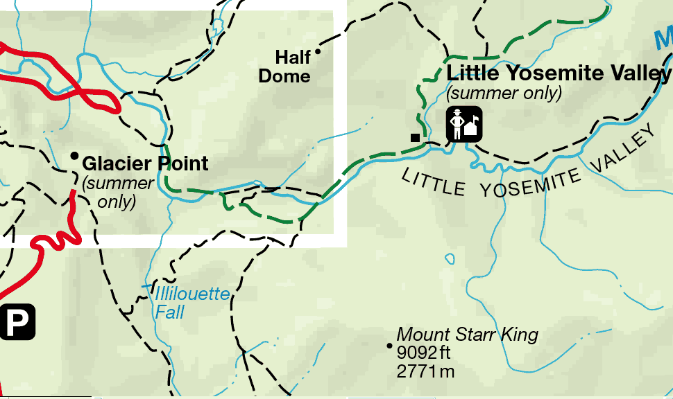 Closer detail of trails leading to Half Dome from Yosemite Valley and Glacier Point. (Trails marked on these maps are for information only.) |
 Hwy 41 (from Fresno) leading from the southern entrance of Yosemite to Yosemite West, location of YosemiteVacation.com vacation home rental. |
 Location of Yosemite West is circled in yellow for identification. Map shows Hwy 140 (From Mariposa), and Hwy 120 (From Manteca), for directions to Yosemite Valley, on to Yosemite West via Hwy 41. |
For a map of just Yosemite Valley in large PDF file format, go to: http://data2.itc.nps.gov/parks/yose/ppMaps/YOSEvalley2003.pdf
Click this link to visit the USGS online "The National Map Viewer" website
shortcut to the Half Dome trail map.
(You should use a high speed internet connection for best use of the above
link.)
| Hiking | Lodging | Photos | Skiing |